How it works
From open data
to a working town.
VeriStreet's pipeline reads national datasets and compiles them into a 3D town you can explore, analyse and export evidence from. The same steps are built to run for any UK city.
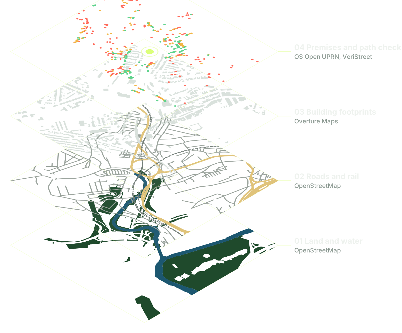
Gather the inputs
Every area starts from open national datasets, pinned so each result can be traced back to its sources.
- Roads, paths, rail and land coverOpenStreetMap
- Building footprints and heightsOverture Maps
- Ground elevationNational LiDAR, such as the Environment Agency and Welsh Government surveys
- Address pointsOS Open UPRN
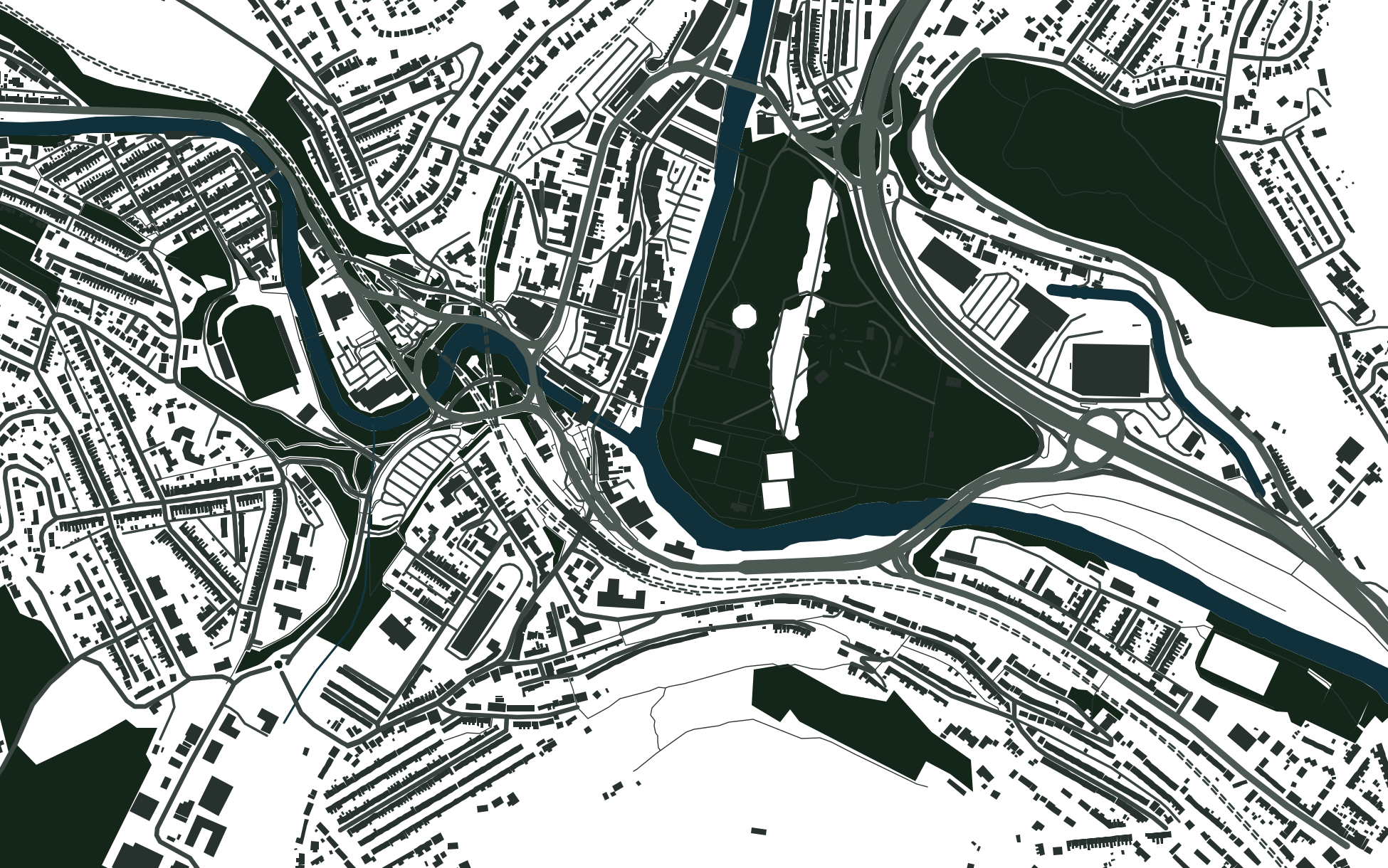
Pontypridd's roads, rivers, land cover and buildings, drawn from the open data the pipeline reads. Compile the town
Roads become lanes, junctions, kerbs, road markings and tactile paving. Footprints become buildings with roofs, chimneys, doors and windows. Elevation shapes the ground, bridges and cuttings, and trees follow mapped canopy.
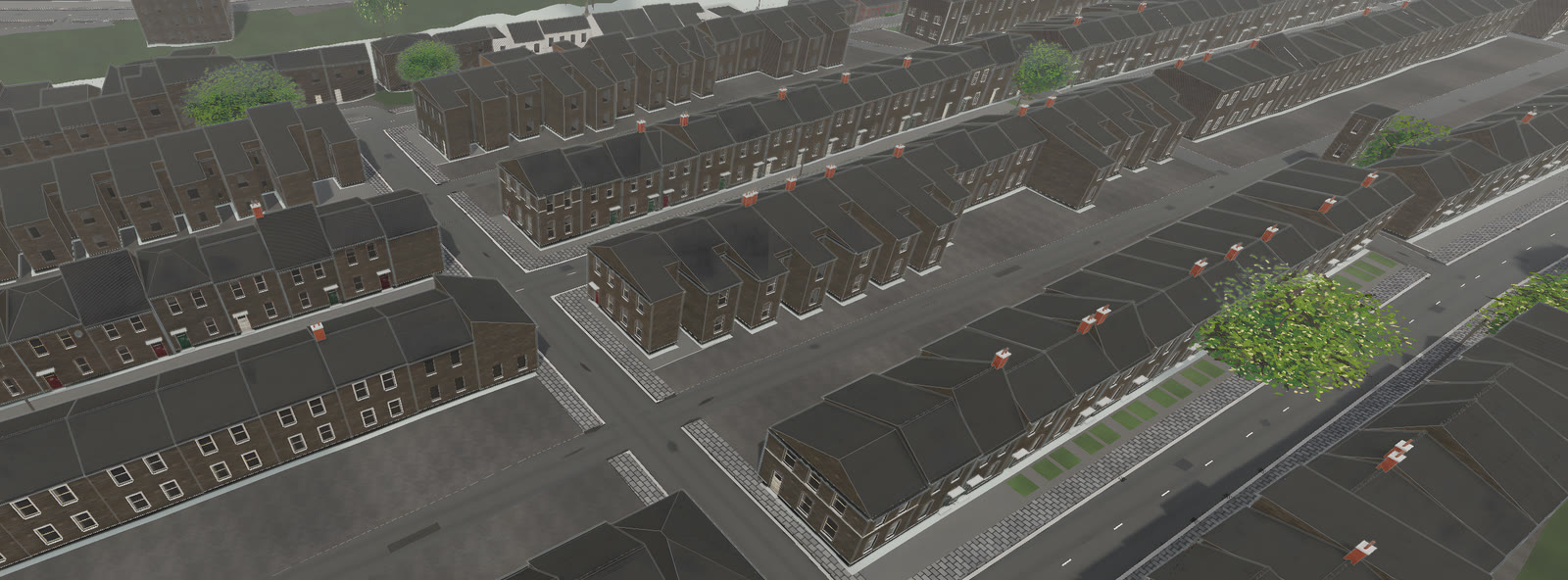
16 September 2026Compiled terraces, roofs, planting and junctions. Explore it in 3D
Open the town in the Windows app, with a linked street map beside the 3D view. Select a premise and both views move to it.
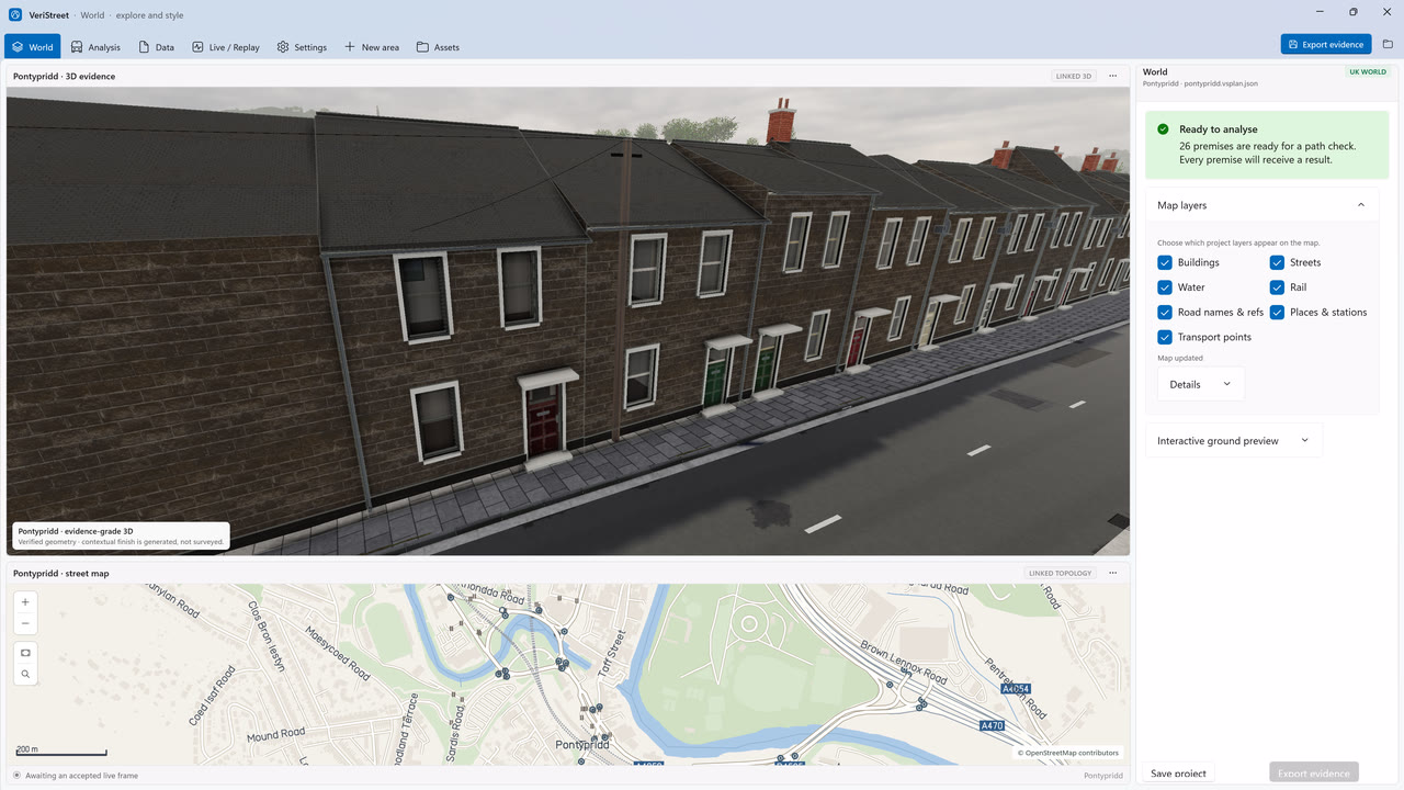
16 September 2026The 3D view and linked map in the app. Analyse a site
Load premises or candidate sites, run path checks and rank road-side positions for masts and cameras.
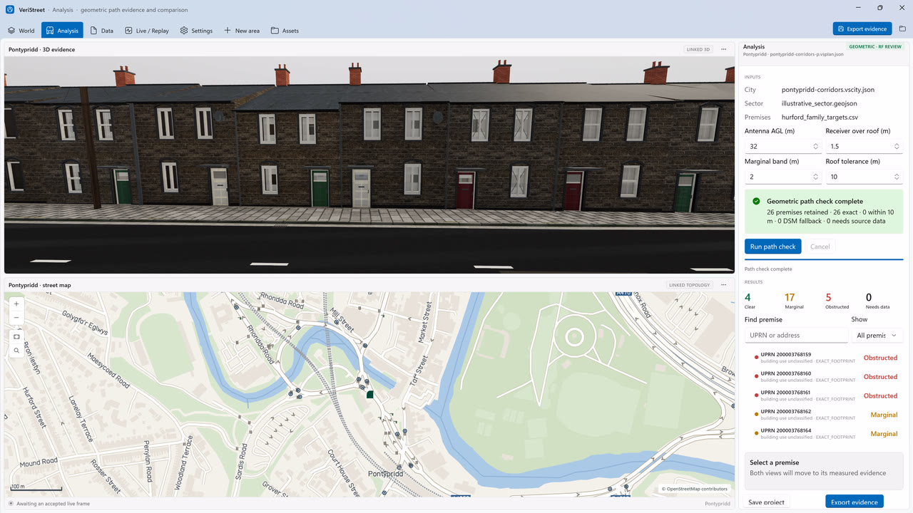
19 September 2026Every premise resolved to a verdict, beside the 3D view. Export the evidence
Save the project and export CSV, PDF and evidence files that record the sources, settings and result behind every verdict.
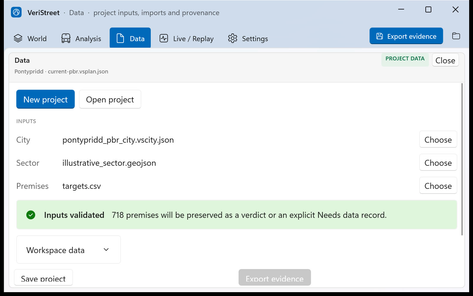
12 September 2026Validated project inputs on the Data page.


Any UK city
One pipeline,
built for any UK city.
Every town comes from the same national datasets and the same steps, with nothing modelled by hand. Pontypridd in Wales is the current showcase.

Where the pipeline is today
A new area is currently compiled offline from a prepared bundle of those datasets. The next milestone is automatic onboarding: name a place, and the pipeline gathers the data and builds the town on its own.
See it in a private demo